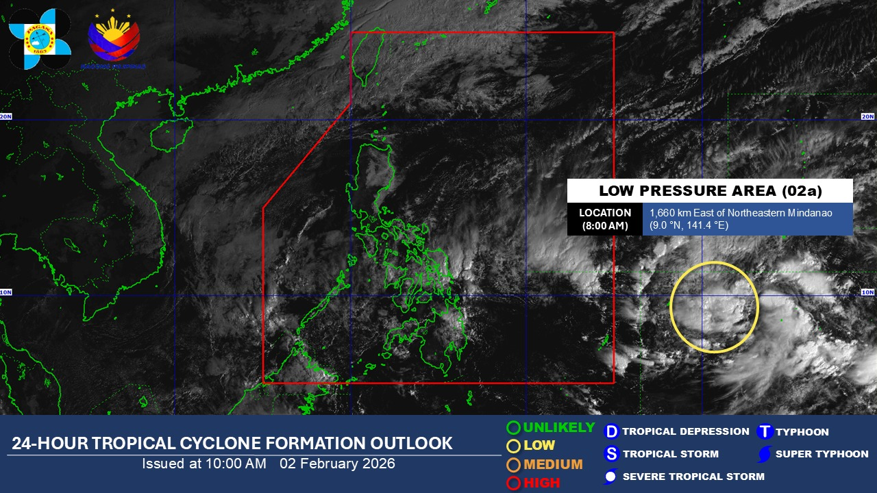

Satellite photo from Pagasa as of 10 a.m., Feb. 2, 2026.
The Philippine Atmospheric, Geophysical and Astronomical Services Administration (Pagasa) reported on Monday morning that a low-pressure area had formed outside the Philippine Area of Responsibility (PAR).
At 8 a.m., the system was located about 1,660 kilometers east of northeastern Mindanao, moving slowly over the ocean.
Pagasa said the disturbance had a low probability of strengthening into a tropical depression within the next 24 hours.
Meteorologists noted that if the system does intensify and enters the PAR, it would be named “Bashang.”
Forecasts indicate that a potential cyclone this month could either curve back toward the Pacific Ocean or track northwest, affecting eastern Visayas and nearby regions.
Earlier, Pagasa projected that zero to one cyclones are likely to form within the PAR in February, keeping overall storm activity relatively low.
Authorities reminded residents to monitor official weather advisories for updates, particularly in coastal areas that could be affected if the system changes course.