
A low-pressure area (LPA) that entered the Philippine Area of Responsibility (PAR) early Friday could develop into the country’s first tropical cyclone of this year, according to the Philippine Atmospheric, Geophysical, and Astronomical Services Administration (PAGASA).
“The low-pressure area we’ve been monitoring over the Pacific Ocean entered the Philippine Area of Responsibility as of 2 am,” Benison Estareja reported, PAGASA’s weather specialist.
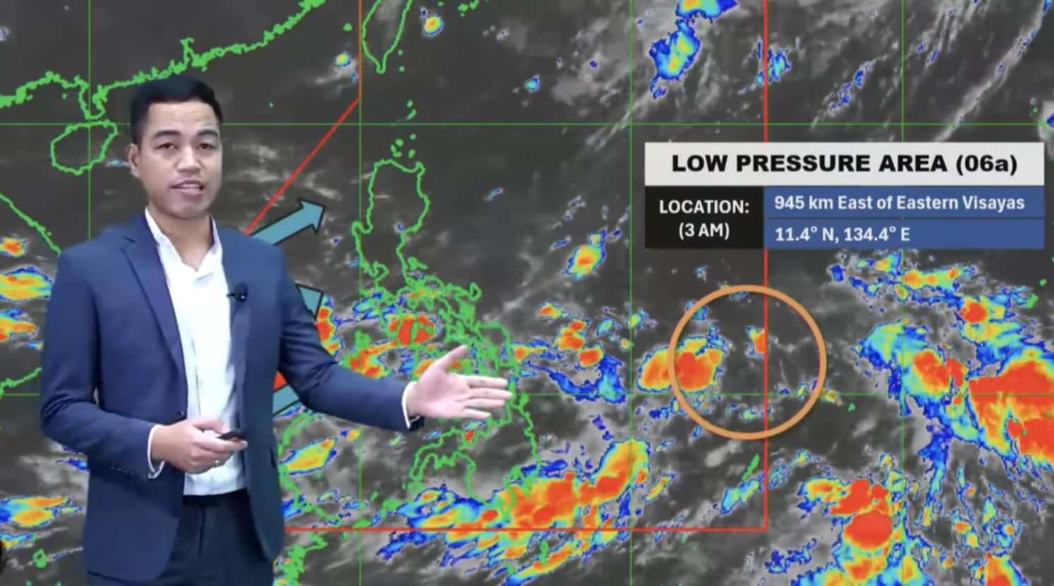
As of 3:00 AM, the LPA was located approximately 945 kilometers east of Eastern Visayas.
There is a “moderate” chance of developing into a tropical depression within the next 24 hours.
“Based on our latest analysis, if yesterday the chance of it becoming a full-fledged storm was low, today the chance is moderate,” Estareja said.
If it develops into a tropical depression tomorrow or on Sunday, the tropical depression will be given the local name Auring, the country’s first tropical cyclone for 2025.
As of 3 pm, PAGASA reported that the LPA was located 34 kilometers East of Virac, Catanduanes.
Rainfalls and thunderstorms are already being experienced in Bicol, Eastern Visayas, Central Visayas, Caraga, Northern Mindanao, and the Davao Region this Friday due to the LPA.