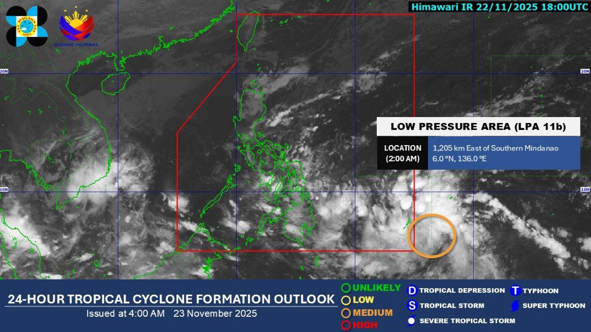
A low pressure area (LPA) situated east of Southern Mindanao has a medium chance of developing into a tropical depression within the next 24 hours, the Philippine Atmospheric, Geophysical and Astronomical Services Administration (PAGASA) announced Sunday.
The weather disturbance, which is expected to be named “Verbena” once it intensifies into a tropical depression, was last estimated at 1,130 kilometers east of Southern Mindanao as of 3 a.m. Sunday, according to PAGASA weather specialist Obet Badrina.
While currently outside the Philippine Area of Responsibility (PAR), the LPA is expected to enter the country’s monitoring area on Sunday. Badrina noted that the potential storm could affect a “big part of Visayas and Southern Luzon.”
Even before its potential intensification, the trough or extension of the LPA is already bringing cloudy skies with scattered rains and thunderstorms across parts of the country, specifically Northern Mindanao, Caraga, Davao Region, Eastern Visayas, and Bohol. Residents in these areas have been warned against possible flash floods or landslides due to moderate to at times heavy rains.
In its heavy rainfall outlook, PAGASA said that 50 to 100 millimeters (mm) of rainfall is expected on Monday in Northern Samar, Samar, Eastern Samar, Leyte, Biliran, Southern Leyte, Cebu, Bohol, Siquijor, Dinagat Islands, Surigao del Norte, Surigao del Sur, Agusan del Norte, Misamis Oriental, and Camiguin.
Looking ahead to Tuesday, November 25, rainfall amounts of 100 to 200 mm are projected for Northern Samar and Eastern Samar, while moderate to heavy rains measuring 50-100 mm may also be expected in several provinces across Southern Luzon, Visayas, and Northern Mindanao.