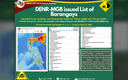

MANILA – Environment Secretary Maria Antonia Yulo Loyzaga on Tuesday called on local government units (LGUs) to use the geohazard map from the Department of Environment and Natural Resources – Mines and Geosciences Bureau (DENR-MGB) to minimize casualties during severe weather conditions.
During a briefing at the Office of Civil Defense (OCD) in Camp Crame, Loyzaga emphasized the importance of using the list of areas prone to flooding and landslides during preemptive and forced evacuations.
“Sana ay gamitin ito ng mga local officials natin dito sa pagdesisyon ng preemptive evacuation at kung saan dapat siguro maging mas ligtas ang mga kabarangay natin dito sa local government (I hope our local officials will use this map in making decisions on preemptive evacuation and where our communities will be safer in the local government),” she said.
Loyzaga stated that the list of flood- and landslide-prone areas in the MGB’s geohazard map is regularly updated based on the latest data from the Philippine Atmospheric, Geophysical and Astronomical Services Administration (PAGASA).
She noted that the list includes villages likely to experience landslides and deep floods.
Loyzaga said the DENR has already submitted the data to the OCD for distribution to LGUs.
“Ang ginagawa ng DENR-MGB ay base sa rainfall data ng PAGASA. Binabangga po namin ang data na ‘yan dito sa alam namin na landslide-prone at flood-prone areas na isinagawa namin (What the DENR-MGB is doing is based on PAGASA’s rainfall data. We compare that data with known landslide- and flood-prone areas that we have identified) in terms of nationwide analysis,” she said.
“So, pag nabangga po namin ang rainfall data at rainfall-induced landslides at flood-prone areas dito sa bansa natin, makukuha po natin ang mga probinsya, mga munisipyo at mga barangay na probably may possible impact nitong mga sistema na ito, kagaya ng Tropical Cyclone Marce (So once we compare the rainfall data with rainfall-induced landslides and flood-prone areas here in our country, we can identify the provinces, municipalities, and barangays that could be impacted by weather systems like Tropical Cyclone Marce),” she added.
Loyzaga explained that typical landslide-prone areas are those near mountainous slopes, while localities near coastal areas, rivers, and low-lying areas are at high risk of flooding.
As Marce approaches the country, she noted, they are closely monitoring major rivers along the typhoon’s path, including the Cagayan River Basin and the rivers in Abra, Laoag, and Vintar in Ilocos Norte, as well as the Cordillera region.
She added that the DENR is also monitoring areas prone to landslides in the Ilocos and Cagayan Valley regions, as well as several areas in Mindanao, warning residents of potential storm surges.
“Kailangan po preventive ang attitude natin. Hindi po natin antayin pa na makaabot na rin ng malalakas na alon sa ating mga kabahayan (We need a preventive attitude. We cannot wait for strong waves to reach our homes),” Loyzaga stressed.
She further explained that the DENR has increased collaboration with dam operators and the Department of Public Works and Highways (DPWH) to better manage water levels in critical dams, including the Magat and San Roque dams, in preparation for heavy rains.
Loyzaga also added that the National Irrigation Administration and the National Power Corporation coordinate with the DENR for the controlled release of water from dams to prevent downstream flooding.
Loyzaga reiterated that as the DENR continues to refine its disaster response strategies, the agency is committed to working closely with local authorities and other concerned agencies to ensure effective information dissemination and preemptive evacuation plans, particularly in areas prone to flooding and landslides. (PNA)