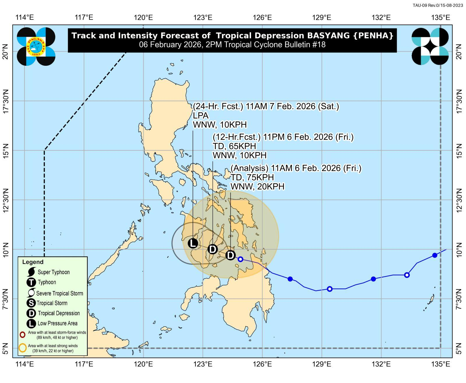

Expected trajectory of TD Basyang as of 2 p.m., February 6, 2026 according to Pagasa.
Tropical depression Basyang made landfall over Bohol on Friday, the Philippine Atmospheric, Geophysical and Astronomical Services Administration (Pagasa) reported in its 2 p.m. bulletin.
As of 1 p.m., the storm was in the vicinity of Bilar, Bohol, moving west-northwest at 20 kilometers per hour. Sustained winds near the center reached 55 kph with gusts of up to 75 kph.
Pagasa said Tropical Cyclone Wind Signal No. 1 remains in effect across parts of Luzon, including southern Occidental Mindoro, southern Oriental Mindoro, northern Palawan, and southern Masbate.
Several areas in Visayas are also under the warning, such as southern Eastern Samar, southern Samar, Guimaras, Iloilo, Capiz, Antique, Aklan, Biliran, Bohol, Cebu, Negros Occidental, Negros Oriental, Leyte, Southern Leyte, and Siquijor.
In Mindanao, affected locations include Dinagat Islands, Surigao del Norte, Agusan del Norte, Misamis Oriental, Misamis Occidental, Camiguin, and Zamboanga del Norte. Residents in these areas may experience winds of 39 to 61 kph over the next 36 hours, posing minimal to minor risk to life and property.
Meanwhile, no gale warning has been issued at this time.
The weather bureau said Basyang is likely to remain a tropical depression while moving across Central Visayas and the Negros Island region before weakening into a low-pressure area (LPA) on Saturday.