
Forecasted track of TD Ada according to Pagasa.
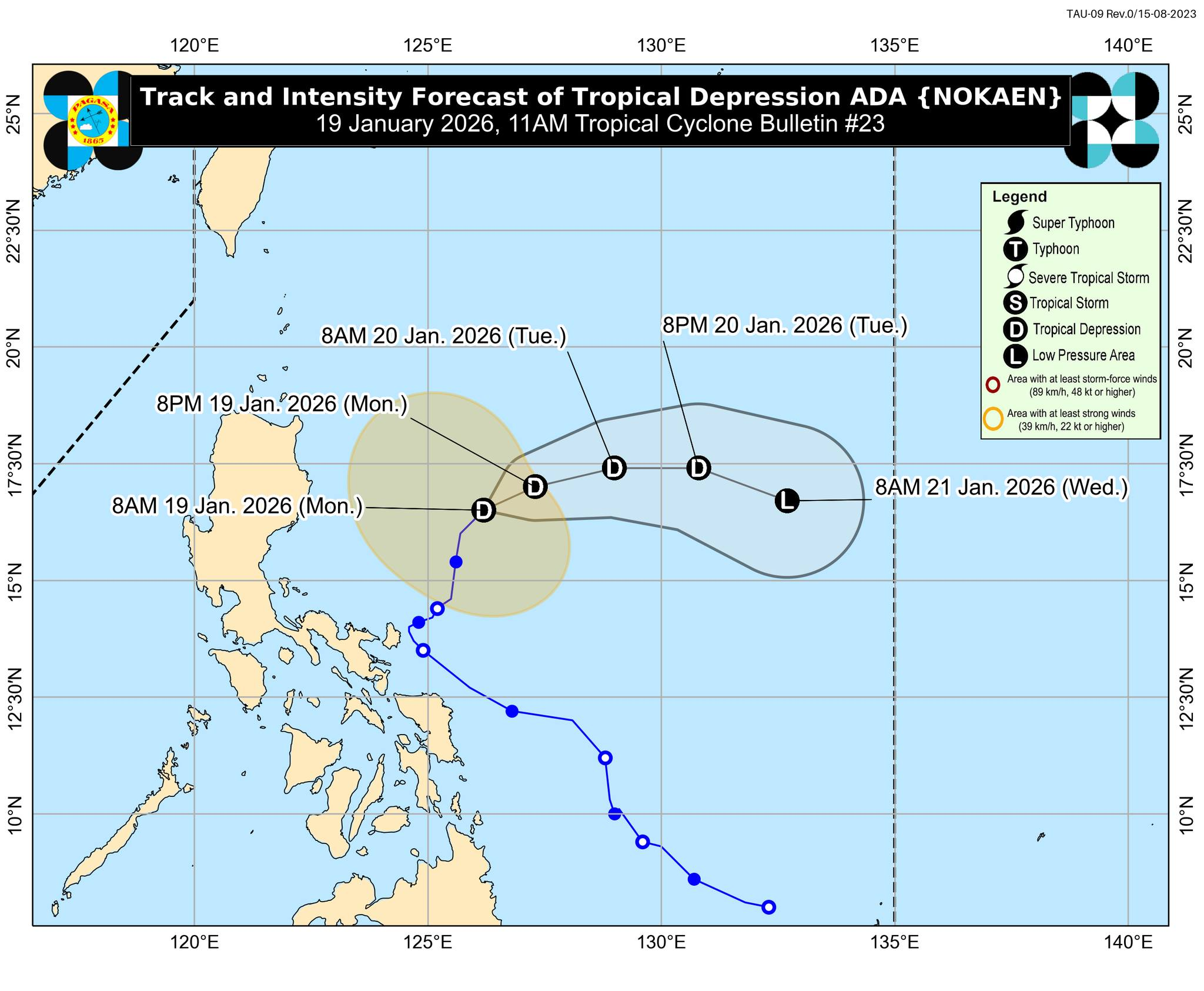
Tropical Depression Ada (international name: Nokaen) continues to move away from Luzon while maintaining its intensity, the Philippine Atmospheric, Geophysical and Astronomical Services Administration (Pagasa) reported Monday morning.
As of 10 a.m., the storm’s center was positioned about 445 kilometers east of Casiguran, Aurora, with maximum sustained winds of 55 kilometers per hour and gusts reaching 70 kph. Its central pressure is at 1000 hectopascals.
Ada is drifting northeast at a speed of 10 kilometers per hour, PAGASA said, and is forecast to track east-northeastward over the next day before shifting toward an east-southeast path by Wednesday.
Forecasters noted that the influx of dry air from the northeast monsoon is expected to gradually weaken the system over the coming days. PAGASA said the depression could downgrade into a low-pressure area by Wednesday, though earlier weakening remains possible.
Despite the weakening trend, strong winds from the northeast monsoon will continue to affect coastal and elevated areas of northern Luzon, including Batanes, the Babuyan Islands, northern and eastern Cagayan, eastern Isabela, Ilocos Norte, Abra, the Polillo Islands, Camarines Norte and Sur, and Catanduanes.
Residents in exposed communities were advised to remain alert and monitor official weather updates, as scattered rain showers and gusty winds may persist in the affected areas.
Authorities also reminded the public that even a weakening depression can still cause localized flooding, landslides, and rough sea conditions, urging fishermen and small boat operators to exercise caution.