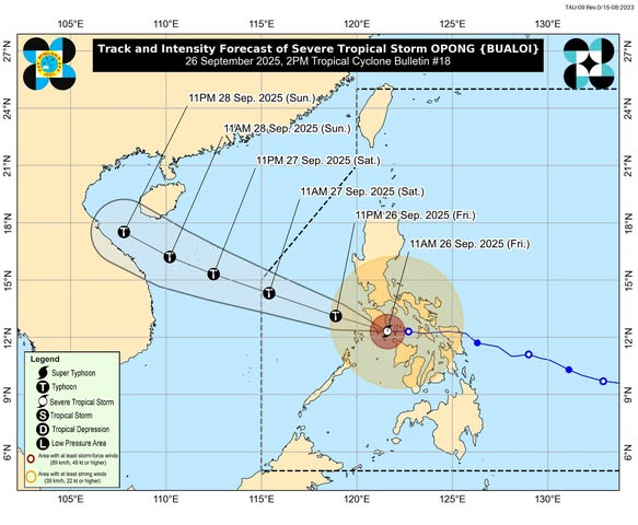

Typhoon Opong continued its destructive march across Luzon as it made its third landfall in Mansalay, Oriental Mindoro at 11:30 a.m. Friday, September 26, bringing fierce winds and heavy rains.
According to PAGASA, the cyclone packed maximum sustained winds of 110 kilometers per hour near the center and gusts reaching up to 150 km/h. It is currently moving westward at a speed of 20 km/h.
Signal No. 3 is up over Batangas, Marinduque, Romblon, Occidental and Oriental Mindoro, the Calamian Islands, and parts of Aklan, where intense winds and torrential rains are expected. Other areas across Luzon and Visayas remain under Signal Nos. 2 and 1.
The state weather bureau warned of widespread heavy rainfall, destructive winds, storm surges reaching one to three meters, and hazardous sea conditions. Residents in low-lying coastal communities were advised to move to higher ground, while fishermen and small seacraft were strongly discouraged from venturing out.
Authorities said evacuation centers are on standby, and emergency response teams are on alert as Opong barrels through the country.
PAGASA added that the typhoon is forecast to exit the Philippine Area of Responsibility (PAR) by Saturday, September 27. However, it may intensify again into a full-fledged typhoon once it moves over the West Philippine Sea.