
Latest satellite from Pagasa as of 5 a.m., Feb. 4, 2026.
Tropical Depression Basyang entered the Philippine area of responsibility (PAR) on Tuesday night, becoming the country’s second tropical cyclone for 2026, state weather forecasters said.
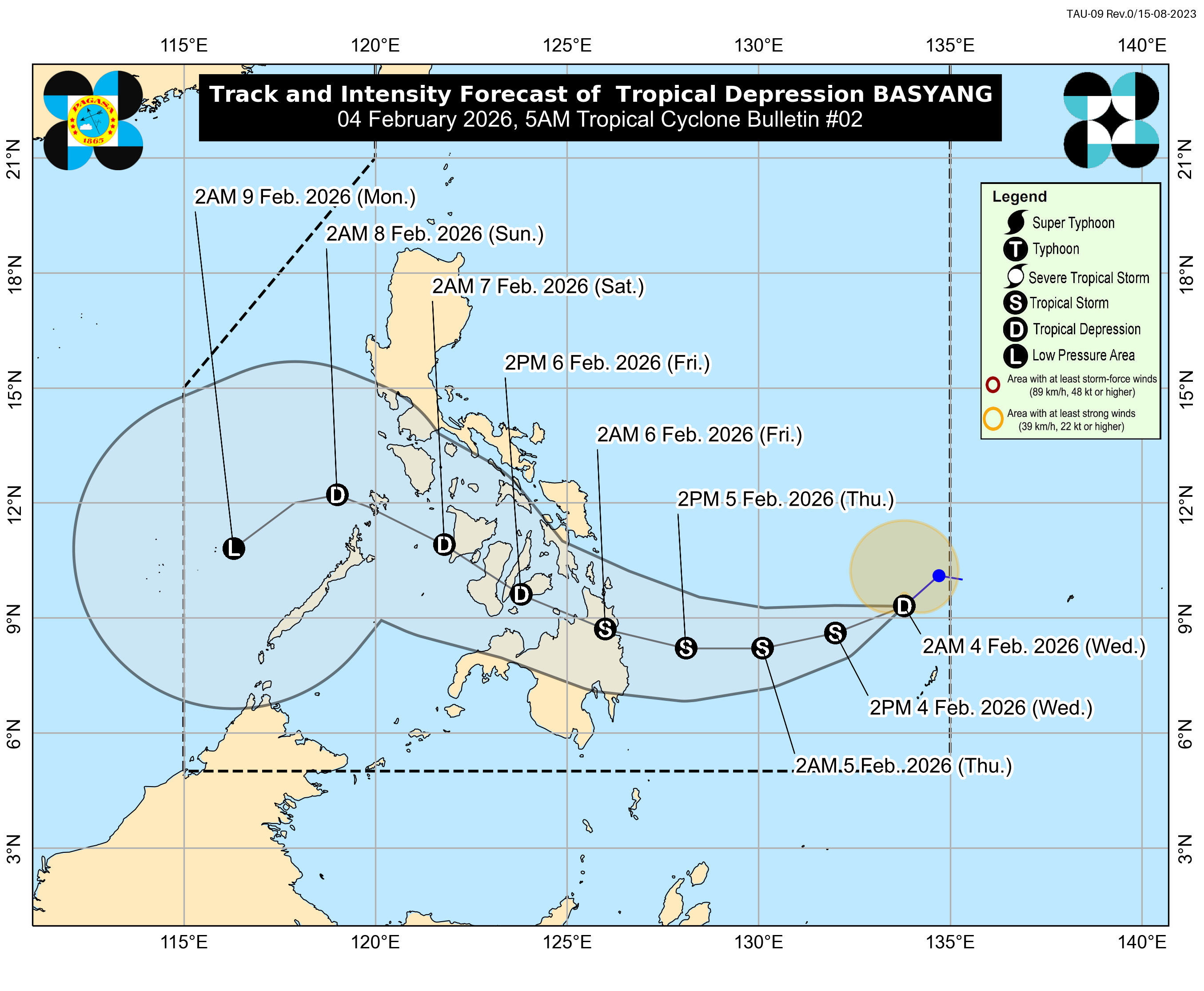
The Philippine Atmospheric, Geophysical and Astronomical Services Administration (Pagasa) reported that the cyclone crossed into the PAR at around 8 p.m. and was last located east-northeast of Northeastern Mindanao.
Basyang was packing maximum sustained winds of 55 kilometers per hour with gusts of up to 70 kilometers per hour and was moving westward at a speed of 10 kilometers per hour, Pagasa said.
No tropical cyclone wind signals were raised as of Tuesday night, but weather forecasters said Signal No. 1 could be declared over parts of the Caraga region by Wednesday morning.
The agency said the cyclone was forecast to move generally southwestward over the Philippine Sea from Wednesday to Thursday and could intensify into a tropical storm by Thursday night.
Basyang may make landfall over central Caraga or southern Eastern Visayas by Thursday evening or early Friday before traversing portions of Mindanao and the Visayas.
Pagasa also warned that the surge of amihan could bring strong to gale-force winds and rough sea conditions in several parts of Luzon, the Visayas, and Mindanao in the coming days.