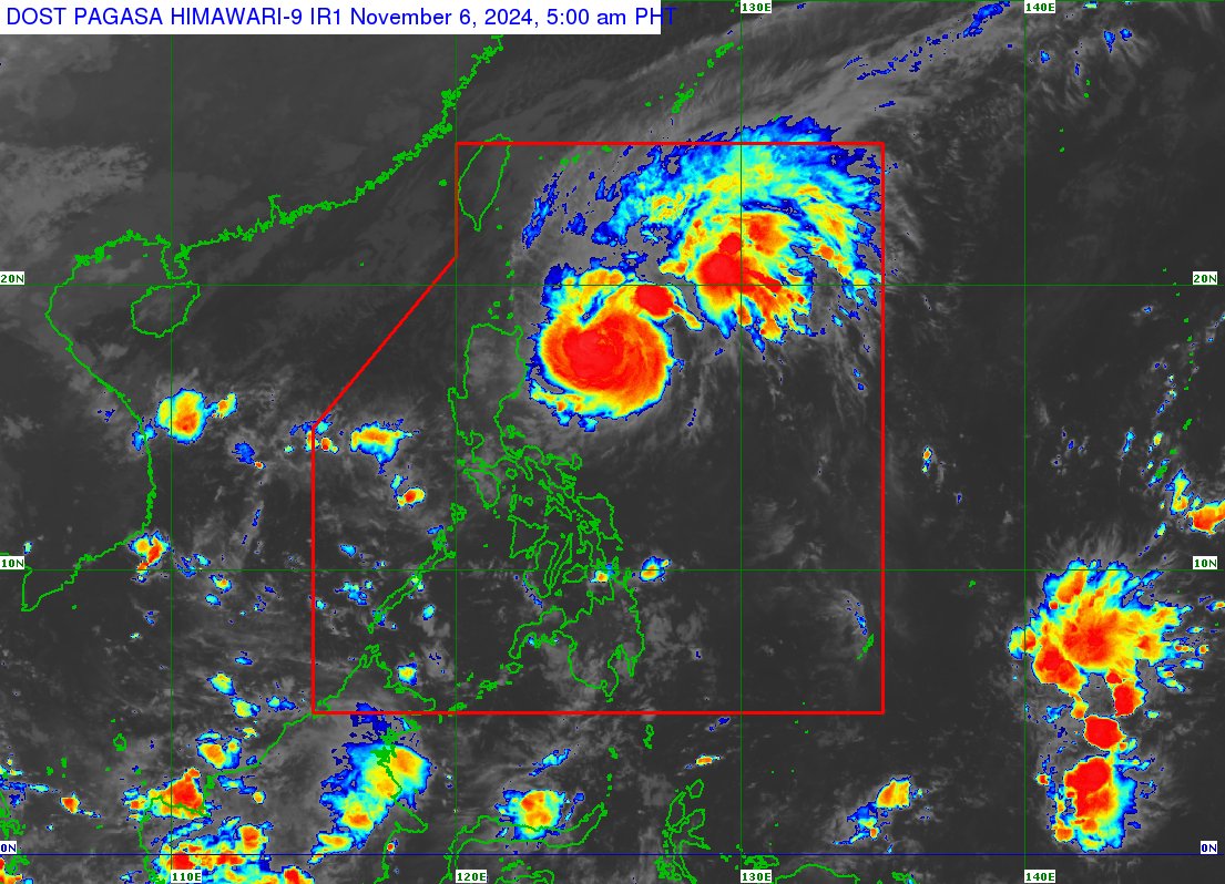
Typhoon Marce maintains its strength as it moves west-northwestward over the Philippine Sea, with Tropical Cyclone Wind Signal No. 2 in effect for eastern Babuyan Islands and northeastern mainland Cagayan, according to PAGASA’s 5:00 a.m. advisory issued on Wednesday, November 6.
As of 4:00 a.m., Marce was located 345 kilometers east of Tuguegarao City, Cagayan, with maximum sustained winds of 140 kilometers per hour (kph) and gusts reaching 170 kph. It is moving northwestward at 15 kph.
Marce is expected to reach peak intensity and slow down as it shifts to a west-northwestward track later this Wednesday. It is then forecast to turn westward and either make landfall or pass very close to the Babuyan Islands or northern mainland Cagayan between Thursday afternoon and early Friday.
Destructive winds from the typhoon’s eyewall, along with torrential rains, will affect Northern Luzon on Thursday and Friday. High seas and storm surges of up to 3 meters are also expected along the coastlines of Cagayan Valley and the Ilocos Region.
Marce is projected to exit the Philippine Area of Responsibility by Friday evening.
Class suspension
Several local government units (LGUs) have suspended classes on Wednesday, November 6, due to Typhoon Marce.
Classes at all levels have been suspended in the following areas: Camarines Sur, Ilocos Sur, Apayao, Quirino, Alcala (Cagayan), Aparri (Cagayan), and Camalaniugan (Cagayan).
Meanwhile, classes in elementary and high school levels have been suspended in Ilagan (Isabela), Dipaculao (Aurora), Bambang (Nueva Vizcaya), and Ilocos Sur.
PAGASA has raised Wind Signal No. 2 over northeastern mainland Cagayan, while Signal No. 1 remains in effect for Batanes and parts of northern Luzon, the Cordillera Administrative Region, and the Cagayan Valley.